Search
-
 Still image
From Ramoth Gilead : N. W. over Jordan valley toward distant Carmel, Palestine
Hurlbut, Jesse Lyman, 1843-1930A view from Al-Salt (Salṭ) across the Jordan River Valley with Mount Carmel barely visible in the background.A view from Al-Salt (Salṭ) across the Jordan River Valley with Mount Carmel barely visible in the background. -
 Still image
Jerash (Gerasa) in eastern Gilead; looking N. over Roman ruins, Syria
Hurlbut, Jesse Lyman, 1843-1930A view of the ancient city of Gerasa near modern Jerash in Jordan showing the ruined remnants of a Greco-Roman city.A view of the ancient city of Gerasa near modern Jerash in Jordan showing the ruined remnants of a Greco-Roman city. -
 Still image
"Roses of Sharon", on the Plain of Sharon
Hurlbut, Jesse Lyman, 1843-1930View of the Plains of Sharon, showing a patch of the plant, Rose of Sharon.View of the Plains of Sharon, showing a patch of the plant, Rose of Sharon. -
 Still image
Relief map of Palestine by the Palestine Ex. Soc.—vertical scale 3 1/2 times greater than horizontal
Hurlbut, Jesse Lyman, 1843-1930View of a relief map prepared by the Palestine Exploration Society depicting the topography of Palestine and identifying various notable locations.View of a relief map prepared by the Palestine Exploration Society depicting the topography of Palestine and identifying various notable locations. -
 Still image
A caravan of camels in the narrow road approaching Jaffa
Hurlbut, Jesse Lyman, 1843-1930A caravan of camels and traders on the road into Jaffa.A caravan of camels and traders on the road into Jaffa. -
 Still image
The house of Simon the Tanner, Jaffa
Hurlbut, Jesse Lyman, 1843-1930View of the house of Simon the Tanner in Jaffa, where Peter stayed during his mission. The story of this is told in the Acts of the Apostles.View of the house of Simon the Tanner in Jaffa, where Peter stayed during his mission. The story of this is told in the Acts of the Apostles. -
 Still image
The Bazaar of Jaffa on a market day
Hurlbut, Jesse Lyman, 1843-1930View of the Jaffa bazaar from above.View of the Jaffa bazaar from above. -
 Still image
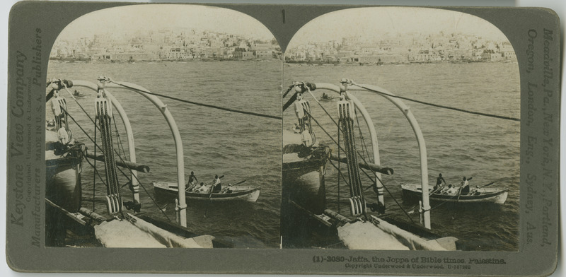
Jaffa, the Joppa of the Bible times
Hurlbut, Jesse Lyman, 1843-1930View of Jaffa (Joppa, in the Bible) from a boat in the Mediterranean.View of Jaffa (Joppa, in the Bible) from a boat in the Mediterranean. -
 Still image
Palestine
A map showing all the areas of Palestine, Israel, Lebanon, and Syria where stereoscopic images were taken.A map showing all the areas of Palestine, Israel, Lebanon, and Syria where stereoscopic images were taken. -
 Still image
Nazareth (En-Nazira)
Williams Engraving Co., N.Y.A map showing the corresponding locations where stereoscopic images were taken of Nazareth and surrounding areas.A map showing the corresponding locations where stereoscopic images were taken of Nazareth and surrounding areas. -
 Still image
Section of Galilee
Bormay & Co. Engravers, N.Y.A map showing the corresponding locations where stereoscopic images were taken of Galilee.A map showing the corresponding locations where stereoscopic images were taken of Galilee. -
 Still image
Samaria (Sebastie)
Bormay & Co. Engravers, N.Y.A map showing the corresponding locations where stereoscopic images were taken of Samaria Region.A map showing the corresponding locations where stereoscopic images were taken of Samaria Region. -
 Still image
The Vale of Shechem (Nablus)
Bormay & Co. Engravers, N.Y.A map showing the corresponding locations where stereoscopic images were taken of Nablus (Shechem) and the surrounding areas.A map showing the corresponding locations where stereoscopic images were taken of Nablus (Shechem) and the surrounding areas. -
 Still image
Jericho and Surroundings
Bormay & Co. Engravers, N.Y.A map showing the corresponding locations where stereoscopic images were taken of Jericho and the surrounding areas.A map showing the corresponding locations where stereoscopic images were taken of Jericho and the surrounding areas. -
 Still image
Bethlehem and Vicinity
A map showing the corresponding locations where stereoscopic images were taken of Bethlehem and the surrounding areas.A map showing the corresponding locations where stereoscopic images were taken of Bethlehem and the surrounding areas. -
 Still image
Jerusalem, Mt. of Olives and Bethany
A map showing the corresponding locations where stereoscopic images were taken of Jerusalem and the surrounding areas.A map showing the corresponding locations where stereoscopic images were taken of Jerusalem and the surrounding areas. -
 Still image
Modern Jerusalem
A map showing the corresponding locations where stereoscopic images were taken of Jerusalem and the surrounding areas.A map showing the corresponding locations where stereoscopic images were taken of Jerusalem and the surrounding areas. -
 Still image
Jerusalem and Vicinity
A map showing the corresponding locations where stereoscopic images were taken of Jerusalem and the surrounding areas.A map showing the corresponding locations where stereoscopic images were taken of Jerusalem and the surrounding areas. -
 Still image
Jaffa
A map showing the corresponding locations where stereoscopic images were taken of Jaffa.A map showing the corresponding locations where stereoscopic images were taken of Jaffa. -
 Text
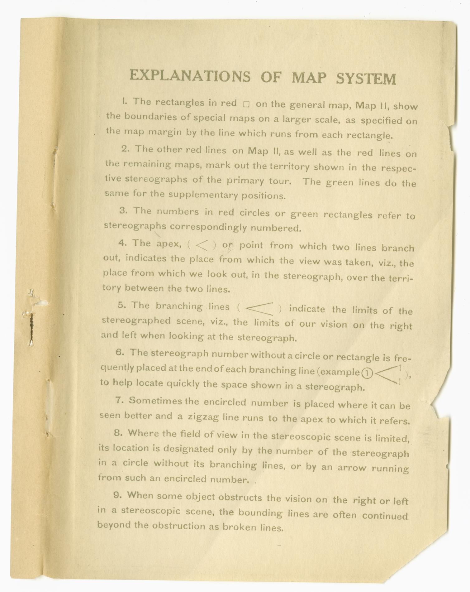
TextExplainations of Map System
A document explaining how to read various symbols and markings on the maps which accompany the steroscopic views of Palestine.A document explaining how to read various symbols and markings on the maps which accompany the steroscopic views of Palestine. -
 Text
TextPalestine Through the Stereoscope
Hurlbut, Jesse Lyman, 1843-1930A guidebook directing readers through a tour of the Holy Land. The book is meant to be used in conjunction with a set of stereoscopic slides which give readers a more in depth and visual compliment to the text.A guidebook directing readers through a tour of the Holy Land. The book is meant to be used in conjunction with a set of stereoscopic slides which give readers a more in depth and visual compliment to the text.
Page 254 of 256